
Introducing the Mountain Directory Ebooks! “Miller designed his two directories for RV as well as truck drivers. RV drivers would face the same problems as truckers. The weight of their vehicles and braking systems that may not be designed to deal with the extreme conditions encountered during mountain descents. Since most road atlases do not include this specific data, many motorhomers will find one or both of these books useful in taking the surprises out of driving in the mountains.” Sherry McBride, Senior Managing Editor, Motorhome

“RVers often have problems with mountain grades–both going up and coming down. It’s helpful to be warned when a steep grade is coming up. That’s just what the two Mountain Directories do.” Coast to Coast
“Color relief maps and more than 150 new mountain pass and grade locations have been added to R&R Publishing’s 1999 editions of Mountain Directory West and Mountain Directory East. Together, the books provide locations and descriptions for more than 700 mountain passes and steep grade locations in 22 states. As well as other vital information for anyone driving a large or heavy vehicle. In Mountain Directory East, the introduction notes that elevation by itself does not indicate a grade’s difficulty. The change in elevation, depicted in the book as percentages, is the critical factor.”
MOUNTAIN DIRECTORY VITAL INFORMATION FOR ANYONE DRIVING A LARGE OR HEAVY VEHICLE!
In an attempt to make mountain driving a little safer for truckers and RV’ers, R&R Publishing Inc. has been collecting and publishing information about mountain passes and steep grades since 1993. The Mountain Directory Ebooks give the locations and descriptions of over 700 mountain passes and steep grades in 22 states.
The Mountain Directory ebooks tell you where the steep grades are, how long they are, how steep (%) they are, whether the road is two lane, three lane,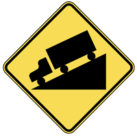 or four lane, if there are escape ramps, switchbacks, sharp curves, speed limits, etc. With this information, one can know ahead of time what a pass is like and make an informed decision about whether to go over or around. If you decide to go over, perhaps the cool morning hours would ease the strain on the engine and transmission during the climb. Unhooking the towed vehicle would make the climb and the descent easier. Knowing what lies ahead is half the battle.
The printed versions of the Mountain Directory books had almost 240 pages of text and color relief maps. All 240 pages are in the downloadable versions of the Mountain Directory ebooks. Nothing is missing. In the printed versions, mountain pass locations were marked with a yellow triangle on the color relief maps. In the ebook versions, you can click on the yellow triangles and the text appears that describes that location.
CLICK HERE FOR FULL DETAILS
Travel with safety – safety from knowledge and information about navigating through the Mountain Grades and Terrain.